Everything I have written on this blog about Banderas Bay comes with the same asterisk: the bay is sheltered. It is roughly a hundred kilometres across, it opens west, and the northern headland eats a large share of the swell before it ever reaches the city beaches. That is why Puerto Vallarta is such a forgiving place to learn, and why we spend so much of the year driving north to find size.
Drive south instead and the asterisk disappears. Past El Tuito, where the highway climbs into cooler air and then drops back toward the water, the coast turns its face straight into the open Pacific. The first place you reach is Mayto — a long, straight, almost empty beach in the municipality of Cabo Corrientes that marks where Banderas Bay ends and the Costalegre begins.
Vallartenses have known it for decades as the weekend escape with a cooler and a tent. What is new is that Mayto now has a hotel on the sand, a working airstrip, and a long-term project attached to it. Since a lot of you ask me where to go when you want ocean without a crowd, here is the honest surf-eye version of the place.
Mayto: where Banderas Bay ends and the open Pacific begins
Cabo Corrientes is the cape that closes Banderas Bay to the south, and it is a genuine hydrographic border, not just a line on a map. North of it you are in protected water. South of it there is nothing between the sand and several thousand kilometres of open Pacific.
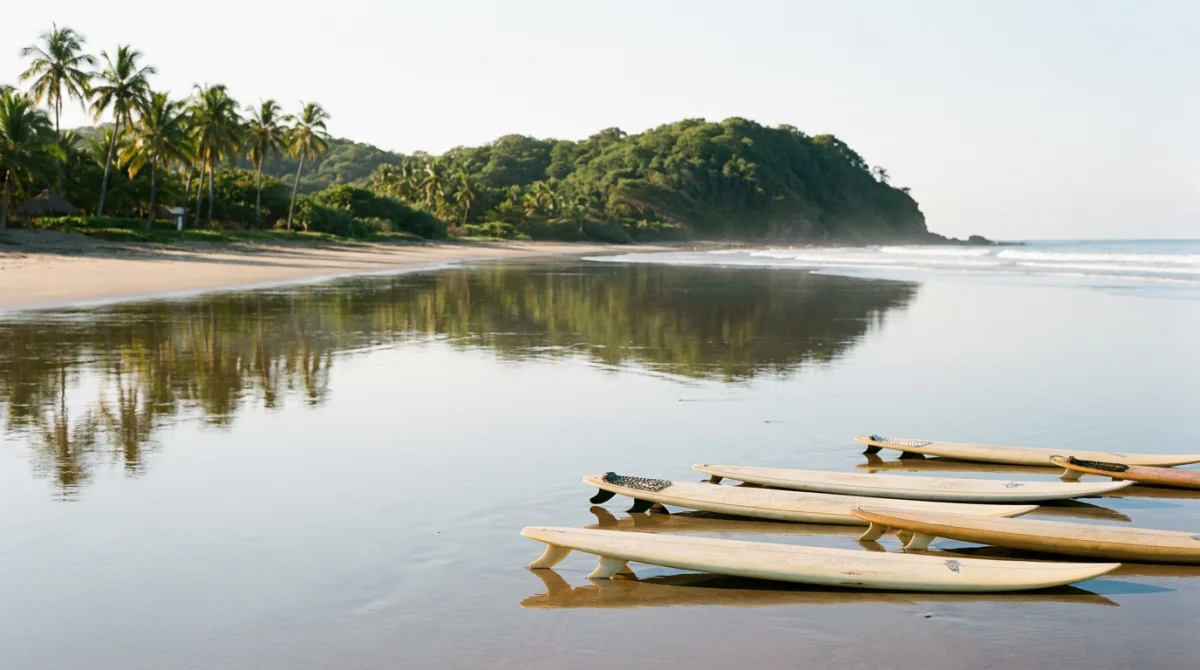
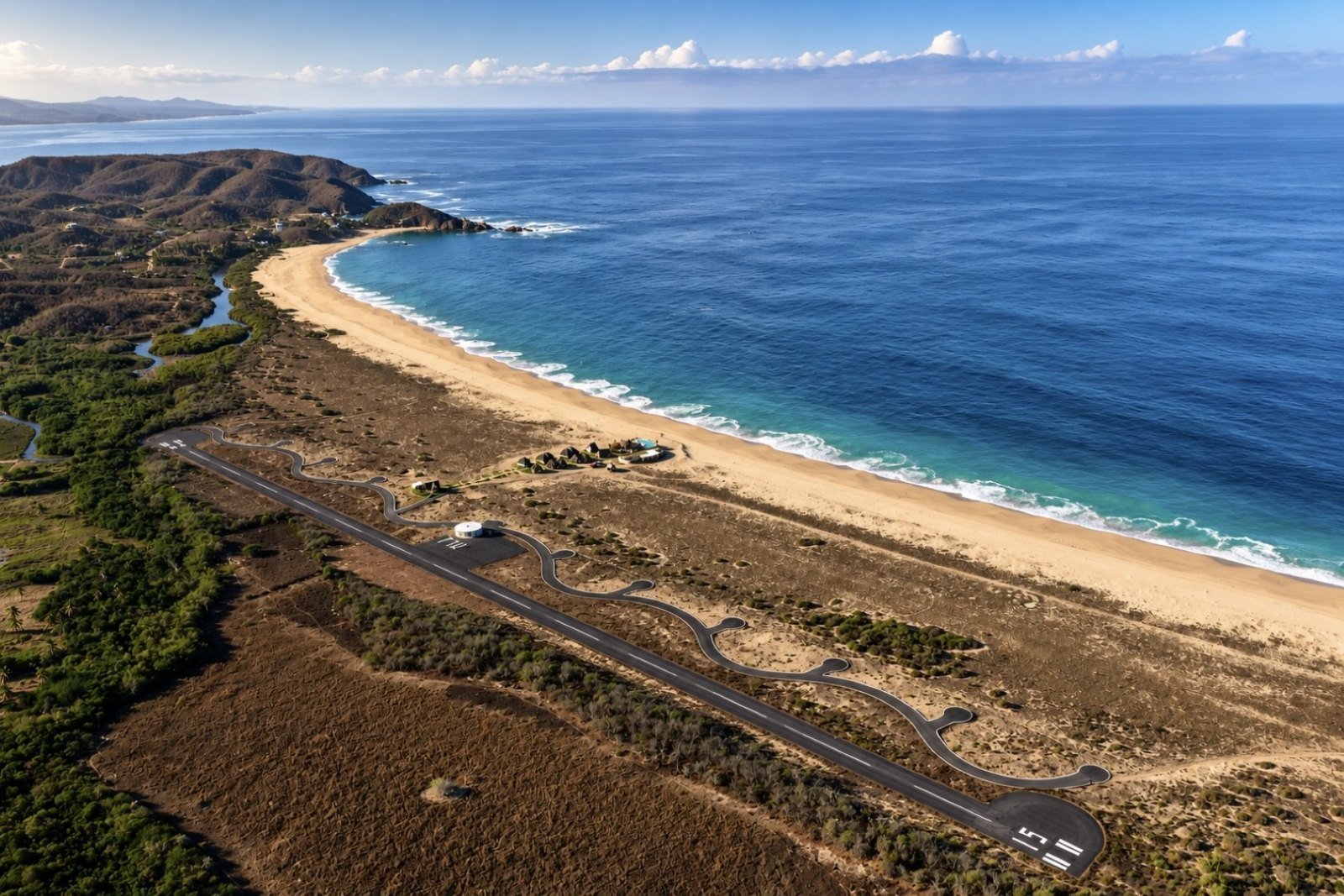
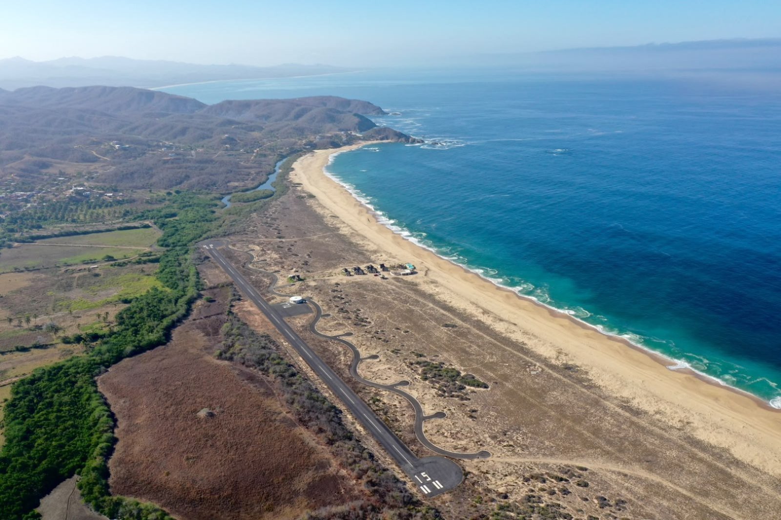
That single fact explains everything about how Mayto feels. The beach is wide, straight and very long — the development that operates there fronts around five kilometres of undeveloped sand — with an estuary and a band of mangrove closing one end and hills behind. From the air it reads as a clean line with nothing on it. No palapas for rent, no jet-ski touts, no music from a beach club two hundred metres downwind.
Getting there by road
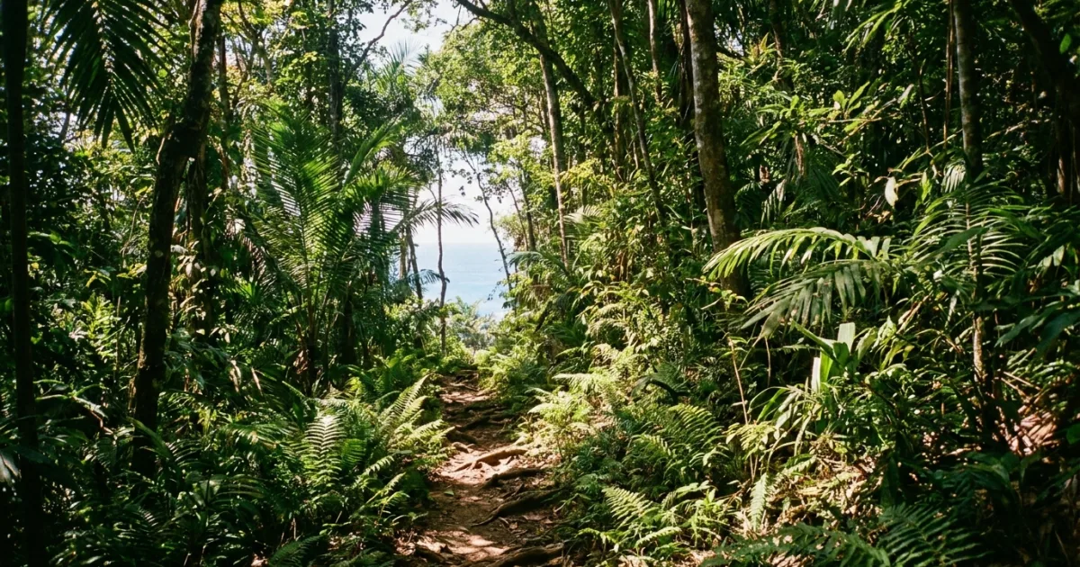
From Puerto Vallarta you take Federal Highway 200 toward Manzanillo, pass through El Tuito, and turn off onto the road that drops toward the coast at Mayto and Tehuamixtle. Reckon on about an hour and a half. The last stretch is narrow and part of it is dirt: perfectly doable in a normal car if you are patient, less fun in the rainy months, when a higher vehicle and a phone call ahead about road conditions are both good ideas.
That drive is the reason Mayto stayed quiet while Sayulita and San Pancho filled up. Access has been the filter, and the beach owes its emptiness to it.
And now: fifteen minutes by air
The filter got a door. Mayto has an airstrip inside the development — paved runway, taxiway, apron and terminal — officially inaugurated on 20 June 2025. For a coast that spent its whole history isolated by its access road, that is a change of category. The destination's own numbers are zero stops, 15 minutes of flight from Puerto Vallarta, and the hour and a half by road as the alternative.
What the water actually does here
Let me be useful rather than romantic, because this is the part that matters if you are reading a surf school's blog.
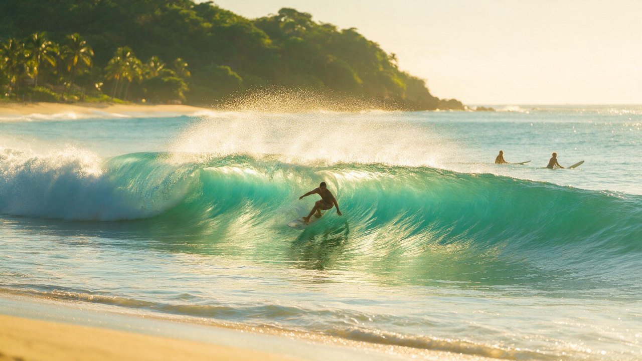
It is an exposed beach break
Mayto — open coast
🌊 No headland, no reef, no protection. It takes swell the city beaches never see.
⚠️ Heavy shorebreak on the sand, rip currents as standard, and nobody watching the water.
Sand-bottom beaches on a straight, exposed coast behave in a predictable way: they take everything that arrives, they dump a lot of it right on the shore, and the banks move around with the seasons. On a big day Mayto is closing out and unrideable. On a small, clean, light-wind morning there can be something there for a surfer who reads water well and is comfortable being self-sufficient. Between those two states, the beach spends most of its time being a beautiful place to walk rather than a place to paddle out.
I say that as someone who makes his living putting people on waves: Mayto is not a lesson beach and I would not take a student there. If you are still learning, the whole logic of this coast is that Banderas Bay is your classroom and the exposed coast is what you graduate into. Our month-by-month guide to surfing Puerto Vallarta lays out where the workable waves actually are through the year.
Rips, and how to be sensible about them
Any beach that takes open-ocean swell moves a lot of water, and water that comes in has to leave. At Mayto it leaves in rip currents. There is no lifeguard service, the nearest hospital is back over the hill, and mobile signal is intermittent.
- Stay shallow if you are just cooling off. Waist deep on an open beach is plenty.
- Watch the beach before you get in. Five minutes of looking tells you where the water is running back out — the calmer, darker, foamless lane is the rip, not the safe spot.
- Never swim alone, and keep children within arm's reach, not within sight.
- If you are caught, do not fight it straight back to shore. Swim parallel to the beach until you are out of the pull, then come in with the whitewater.
- Bring a board leash you trust. On a beach with no one on it, your board is your flotation.
So who is this beach for?
People who want ocean without infrastructure. It is a walking beach, a running beach, a sunrise beach, a beach for driving a quad along the hard sand and for sitting with your back to a dune watching a swell you have no intention of surfing. If your idea of a good day involves not seeing another person, this is the best five kilometres on the Jalisco coast for it.
The turtles, which is the other reason to come
Mayto is a sea turtle nesting beach and there has been a community turtle camp working the sand for years. Depending on the season, hatchling releases happen at dusk — one of the main reasons Vallarta families make the drive with kids in the back.
Dates depend on when the nests arrive, not on a published calendar, so ask locally when you get there. And the etiquette matters on a nesting beach: keep vehicles off the marked zones, take your rubbish out with you, and never shine a light directly at a turtle if you are lucky enough to see one come up.
The airport, precisely
This gets exaggerated online, so here is the accurate version. The Mayto airstrip is presented by the project as Mexico's first themed airport, and the theme is real rather than a brochure line: the taxiway is deliberately sinuous, a tribute to the serpent of the Tenochtitlan legacy, and from the air the shape is unmistakable. The terminal is a circular white volume with a four-pointed star on the roof, and the letters MJL are painted on the apron.
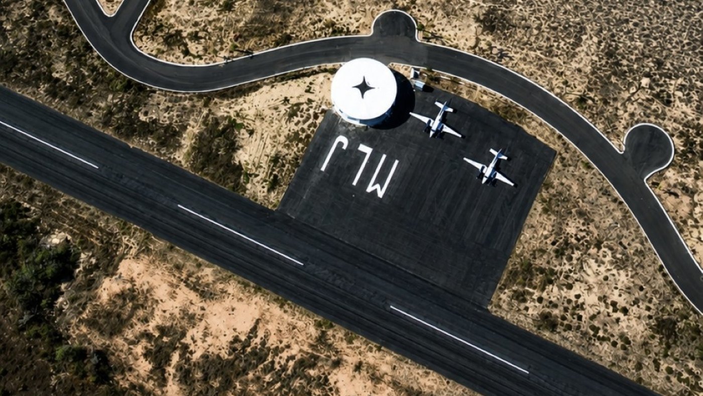
What it is: a strip for general aviation and private operation — light aircraft, executive planes, charter flights. What it is not: a commercial airport. There are no scheduled airlines, no baggage belts, no immigration hall. It does not replace or compete with Puerto Vallarta International; it leans on it. You still fly commercially into PVR, and then you either drive or hop.
Where to stay if you are not driving back
The lodging at the development is a small run of beachfront rooms under palapa roofs, a few steps from the runway, with a pool and the common area facing the ocean. It is deliberately small: a handful of suites on an enormous beach rather than a tower.
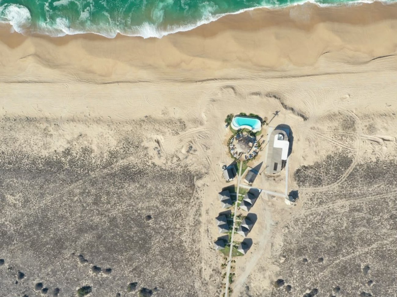
There is a single category of suite — king bed under palapa, warm lighting, private terrace, ocean view — which is a sane decision for a place this size. It runs year-round, and you can book directly through mayto.com/booking, by email at reservations@mayto.com, or on +52 33 3822 5731. If you are flying in, they will put the flight, the room and the park access together as one arrival, which is the least painful way to organise it.
And the sky, which nobody built
Two things about spending the night on an undeveloped coast. The first is silence — with no town around, the only sound is the shorebreak, and after a week of Vallarta that lands harder than you expect. The second is the sky. No city means almost no light pollution: the Milky Way is visible with the naked eye, which on this stretch of Jalisco is genuinely uncommon.
The project has leaned into it with the Parque Astrológico: twelve roundabouts, one per zodiac sign, acting as gateways to twelve Zodiac Temples, plus six open-air themed experiences and an observatory. Set your expectations correctly, though — it is being built in phases, the first temple (Virgo) is projected for 2027, and what operates today is the air access and the beachfront lodging. Go this year for the sand, the silence and the stars; the temples are the long film.
Mayto seasons, from a water point of view
- December to March. Northwest swell season and the driest road. Cooler water, cleanest conditions, the easiest months to organise the drive.
- April and May. Transitional, often small, beautiful weather. The gentlest time to visit an exposed beach.
- June to October. South swell season — the most size of the year on the open coast, and also the rainy months. Mornings are usually cleanest; the access road is at its worst.
- November. The reset: green hills, warm water, quiet everywhere.
What to take
- Cash. Rural coast, no reliable ATM.
- A full tank. Fill up in Vallarta or El Tuito, not on the way down.
- Downloaded maps. Signal comes and goes.
- Reef-safe sunscreen, repellent, hat, water and a torch. There is no street lighting at night.
- Your own shade. That beach has none.
Frequently asked questions
Can you surf at Mayto?
It is an exposed beach break with no protecting headland, so it picks up swell the bay never sees. On a big day it closes out; on a small, clean morning an experienced surfer may find something. There are no lifeguards, no board rental and no one to help if it goes wrong, so it is a self-sufficient session or none at all. Beginners belong inside the bay.
How long does it take to get to Mayto from Puerto Vallarta?
About an hour and a half of driving via Highway 200 and El Tuito, with a final narrow and partly unpaved stretch — or 15 minutes of flight if you arrive at the development's own airstrip.
Is Mayto good for swimming?
Not in the way Las Ánimas or Yelapa are. It is open ocean with heavy shorebreak and rip currents, and no lifeguard service. Stay shallow, never swim alone, and treat it as a walking beach that happens to have water.
Can I fly to Mayto on a commercial flight?
No. The strip is for general aviation, private and charter flights only. The commercial route is still Puerto Vallarta International, and from there by road or in a light aircraft.
What else is nearby?
Tehuamixtle, a small fishing cove about eight kilometres on, where the water is calm enough to swim and the palapa restaurants are known for oysters. Most people who make the drive do both in the same day.
When should I go if I want the stars?
Plan around the new moon. A full moon washes the sky out and you lose the Milky Way — which is most of the point of staying the night.
Is it worth it as a day trip, or should I sleep there?
You can do it in a day from Vallarta and plenty of people do. But three hours of driving for a beach you will leave before dark is a poor trade when the strongest argument for the place is what happens after sunset.
Is this a good rest-day trip in the middle of a surf trip?
It is a great one — as long as you understand you are going to look at the ocean rather than surf it. If the bay is flat and you want a day out of the water instead, our guide to flat days in Puerto Vallarta covers the closer options.
The short version
Mayto is what this coast looks like without the bay in front of it: five kilometres of empty sand, an estuary, turtles, real ocean and a sky with the Milky Way still in it. Respect the water, go with a full tank and cash, and stay the night if you can.
If you want to see the whole destination — airstrip, beachfront hotel and Parque Astrológico — or put an arrival together, it is all at mayto.com. And if you are building the rest of the trip around Banderas Bay, the wider Puerto Vallarta travel guide, the list of things to do in Puerto Vallarta, the ATV and jungle tour operators and the boat and fishing charters will fill the days you are not driving south. In Spanish, the same ground is covered in the guía de Puerto Vallarta.
Learn where the ocean is patient.
Mayto is the graduation. The bay is the classroom — small, clean and forgiving, with boards and transport included.
Book a Surf Lesson →